Saturday I woke up at 3:15 am. I drove to American Fork Canyon. Meet my group and climbed this... the Northeast Ridge of Mount Timpanogos. We started at the left of the picture and ended almost at the right of the picture. 9.6 miles total. (It felt more like 20) 15 hours of climbing. Total elevation = 5,343 feet of climbing
 5:30 am- Started hiking. 5 minutes in we had to take off our shoes, socks, and gators to ford this river. It was wide but thankfully not deep.
 Phase one- Hike up three long, steep, snow fields. We put on our crampons and hiked as the sun rose.
 Here is the second snow hill on the right. We had to get to the top of that mountain for our first peak of the day.
 This one was very long and very steep. We were cooking hot! This is called Wolley Hole I think
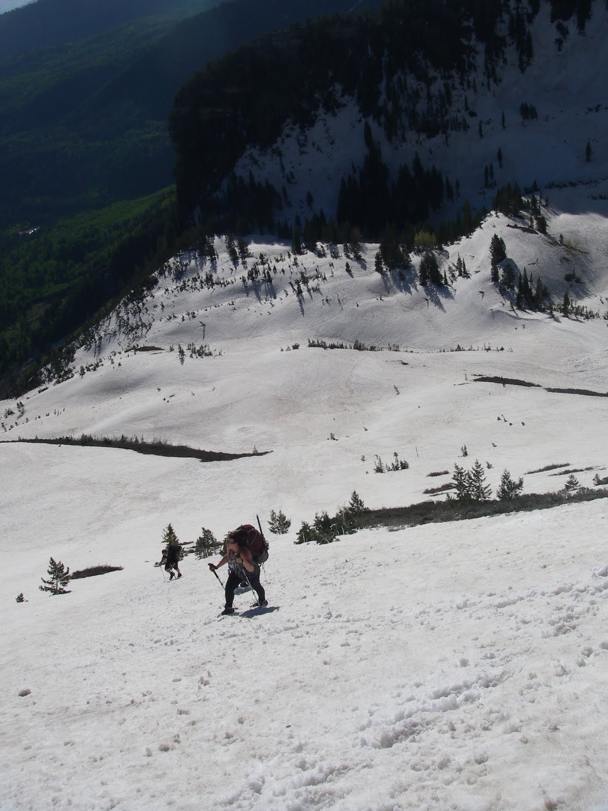 Finally got to the top of the second snow field ... one more to go. Time to rope up.
 We are climbing Mnt Rainer in Washington in a few weeks. So we had to practice roping up incase of an accident. You have to be about 30 feet apart and not let the rope have to much slack.
The last of the 3 snow fields to climb. We have to make it to the top of this.
 8:30 am -Finally we make it here. It was pretty windy all day. Utah Lake looked great in the distance. We were in coats and gloves, the people on the lake were in swim suits.
 Our Goal- Hit 4 peaks before the end of the day. We had just summited North Peak - Elevation of 11,383 feet and our end goal was way in the distance. Timpanogos at 11.749 feet. On the way passing North Timp Peak and Bomber Peak.
 Buckle in for a long day. You can see some of our climbing group- little ants down in the rocks.
 We got closer and closer. Timpanogos is in the distance. We hiked on loose rock all day. A few times having to cross patches of snow. I didn't look down as I hiked on those snow patches, knowing if I slipped it would be a long long long way down. (we weren't roped to each other anymore!) You cant see the trail but just imagine walking along the top of this ridge for hours.
 This is a great shot of what we hiked on all day. It scares me to look at the photo. Good grief, what were we thinking!

2:00 pm- We finally made it to the top. The hut on top was a great site to see.
 We started to head down. Unfortunately there had just been an avalanche in the past few days on our trail out. It was too dangerous to go that way. So we opted for the next way out... the only other way out... the FUN way out!
 We got closer and closer. Timpanogos is in the distance. We hiked on loose rock all day. A few times having to cross patches of snow. I didn't look down as I hiked on those snow patches, knowing if I slipped it would be a long long long way down. (we weren't roped to each other anymore!) You cant see the trail but just imagine walking along the top of this ridge for hours.
 This is a great shot of what we hiked on all day. It scares me to look at the photo. Good grief, what were we thinking!
2:00 pm- We finally made it to the top. The hut on top was a great site to see.
 We started to head down. Unfortunately there had just been an avalanche in the past few days on our trail out. It was too dangerous to go that way. So we opted for the next way out... the only other way out... the FUN way out!
We had to glissade on our tail ends. You sit down, you push off, you start to slide and when you get going to fast or come to a cliff you use your ice ax to slow down/stop yourself.
We started at the top of this picture and went forEVER! down, down, down.
 Our tail ends were numb by the end. See the blue ski at the top of the mountain where the saddle scoop is... start sliding there ... go until you reach the end of this picture. It was incredible!
 5:30 pm- Then the painful part. We were exhausted and had three miles to hike out. Our knees, toes, bodies were TIRED! We pooled our food, ate it ALL, and headed out the last three miles. We hadn't anticipated such a long day. So we literally ate every thing we had!
7:30 pm- made it out of Dry Creek Canyon in Provo. We had to call a friends wife to come get us. She then drove us back to our cars in a totally different canyon (AF canyon). Then I had to drive back to Sandy.
9:30 pm- Pull in the driveway. Eat a bowl of cereal very slowly. No food sounds good which is very strange for me... I just wanted a shower and bed.
10:00 pm- ZZZZzzzzzz
So here's hoping I can hack it on Mnt Rainer in July. OH BOY!
3 comments:
Every post you seem to top yourself. Whew just trying to keep up with all that you do makes me tired! Super woman indeed! Looks beautiful!
oh my.
i enjoyed your play by play! THanks!
Post a Comment